TianShan Mountains in Xinjiang

Tian Shan Mountains, also called Tien Shan, Celestial Mountains or Heavenly Mountains. With its particular geological structure and stunning natural landscape, the mountain has been inscribed in the World Heritage List by the UNESCO on June 21st 2013.
Type: Nature Landscape
Chinese Name: 天山山脉
Location: Xingjiang
Tian Shan Mountains, also called Tien Shan, Celestial Mountains or Heavenly Mountains. As one of the Seven Mountain Systems in the world, Tian Shan Mountains stretches through four countries with a length of 2,500 kilometers from east to west. With its particular geological structure and stunning natural landscape, the mountain has been inscribed in the World Heritage List by the UNESCO on June 21st 2013.
The Tianshan Mountains (天山山脉) are one of the seven major mountain ranges in the world. Located in the heart of the Eurasian continent (欧亚大陆), they are the largest independent latitudinal mountain range on Earth. The Tianshan Mountains are also the farthest mountain range from any ocean and the largest mountain range in the world’s arid regions.
The range stretches across four countries: China (中国), Kazakhstan (哈萨克斯坦), Kyrgyzstan (吉尔吉斯斯坦), and Uzbekistan (乌兹别克斯坦). It extends 2,500 kilometers from east to west, with an average width of 250 to 350 kilometers, reaching up to 800 kilometers at its widest. The highest peak, Tomur Peak (托木尔峰), stands at 7,443 meters above sea level and is located in Xinjiang, China. The Tianshan Mountains in Xinjiang refer specifically to the eastern Tianshan, which spans 1,760 kilometers, or more than two-thirds of the entire range. This section crosses nine administrative regions in Xinjiang, including Kashgar (喀什), Aksu (阿克苏), Ili (伊犁), Bortala (博尔塔拉), Bayingolin (巴音郭楞), Changji (昌吉), Urumqi (乌鲁木齐), Turpan (吐鲁番), and Hami (哈密). The range serves as a natural geographical boundary between the Junggar Basin (准噶尔盆地) and the Tarim Basin (塔里木盆地), making it a unique geographical feature of Xinjiang.
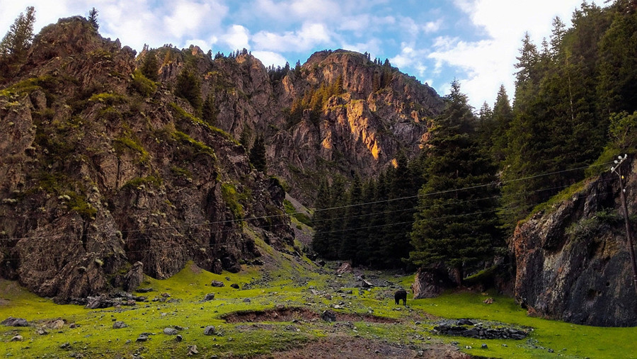
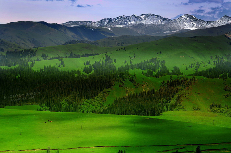
The Tianshan Mountains are home to a diverse array of climates and landscapes, from scorching deserts to freezing peaks, from arid regions to moist meadows, offering a striking blend of desolation and beauty. This diversity includes snow-capped mountains, ice peaks, forests, grasslands, rivers, lakes, and red layer canyons. It is also the origin and best habitat for snow-covered spruce forests (雪岭云杉) and wild fruit forests in Central Asia (中亚野果林), and an important habitat for many rare, endangered, and endemic species of the Central Asian mountain regions.
World Heritage Status
On June 21, 2013, four areas of the Tianshan Mountains in Xinjiang—Tomur Peak (托木尔峰) in Aksu, Karajun-Kurdening (喀拉峻—库尔德宁) in Ili, Bayinbuluke (巴音布鲁克) in Bayingolin, and Bogda (博格达) in Changji—were successfully inscribed as a UNESCO World Natural Heritage Site under the name “Xinjiang Tianshan” (新疆天山), becoming China’s 44th World Heritage Site. The total area of the site is 5,759 square kilometers.
Geographical Information
- Location: Eurasian continent (欧亚大陆)
- Length: 2,500 km
- Width: Average 250—350 kilometers, with a maximum of over 800 kilometers
- Highest Peaks: Tomur Peak (托木尔峰), Khan Tengri Peak (汗腾格里峰), Bogda Peak (博格达峰)
- Countries: China (中国), Kazakhstan (哈萨克斯坦), Kyrgyzstan (吉尔吉斯斯坦), Uzbekistan (乌兹别克斯坦)
Climate and Ecology
The Tianshan Mountains are a unique intersection of extremes: hot and cold, dry and wet, barren and beautiful, rugged and refined. This makes the range exceptionally rich in aesthetic, geological, and ecological diversity. It is home to snow-capped mountains, ice peaks, forests, meadows, rivers, lakes, and dramatic red-layered canyons. The region also provides a habitat for many rare and endangered species, including the snow-covered spruce and wild fruit forests, making it a global biodiversity hotspot.
Formation and Evolution
The TianShan Mountains have both ancient and youthful characteristics. The range’s modern formation began through intense tectonic movements during the Paleozoic, Mesozoic, and up to the late Neogene and early Quaternary periods. These stages involved folding, uplift, erosion, and fault-block movements, with internal and external forces shaping the landscape at different times.
Paleozoic Folding and Uplift
The TianShan region underwent significant folding during the Caledonian and Hercynian movements, leading to the formation of a mountain range. The folding process was most pronounced in the Central TianShan, which became the core of the mountain system, while the surrounding regions, like the northern and southern TianShan, also experienced tectonic activity.
Mesozoic and Early Tertiary Erosion
During the Mesozoic, the region was largely eroded, and surrounding depressions like the Turpan-Hami Basin, Ili Basin, and others formed. The region remained relatively stable in terms of tectonic activity during this period, with sedimentation occurring in the basins.
Late Tertiary to Quaternary Uplift
From the late Tertiary to the Quaternary period, intense tectonic movements led to the fault-block uplift of the TianShan, resulting in the towering mountain ranges seen today. This uplift also caused the formation of new foothill basins and further fault-block sinking in the interior.
Location and Geography (位置境域)
The TianShan Mountains (天山山脉) are one of the seven major mountain ranges in the world. Located in the heart of Eurasia, the world’s largest landmass, the range stretches from the Xinxing Gorge (星星峡) in Hami, Xinjiang, China, in the east to the Kyzylkum Desert (克孜勒库姆沙漠) in Uzbekistan in the west. It runs nearly east-west and spans across four countries: China, Kazakhstan, Kyrgyzstan, and Uzbekistan. The TianShan Mountains are the largest independent latitudinal mountain range in the world, the farthest from any ocean, and the largest mountain range in the world’s arid regions.
The TianShan Mountains stretch approximately 2,500 kilometers from east to west, with an average width of 250 to 350 kilometers, and at their widest, over 800 kilometers. In China, the mountain range stretches more than 1,700 kilometers from the western border to the west of Xinxing Gorge, making up over two-thirds of the total length of the range. In the former Soviet Union, the range extends about 800 kilometers, nearly a third of its total length.
Xinjiang TianShan (新疆天山) in China is home to the highest peak, Mount Tomur (托木尔峰), which rises 7,443 meters above sea level. The TianShan Mountains also form a natural geographical boundary between the warm temperate Tarim Basin (塔里木盆地) to the south and the Gobi Desert (戈壁) to the north. These mountains are embraced by two vast deserts, the Taklamakan Desert (塔克拉玛干沙漠) and the Gurbantünggüt Desert (古尔班通古特沙漠). The TianShan Mountains divide Xinjiang into northern and southern regions, crossing several prefectures such as Kashgar (喀什), Aksu (阿克苏), Kizilsu Kyrgyz Autonomous Prefecture (克孜勒苏柯尔克孜自治州), and many others. It is a distinctive feature of Xinjiang’s geography.
Terrain and Topography
The average elevation of the TianShan Mountains is 4,000 meters, with numerous peaks exceeding 5,000 meters in height. The highest peak, Mount Tomur (托木尔峰), reaches an elevation of 7,443 meters. The difference in elevation between the TianShan range and the neighboring Tarim and Junggar Basins (准噶尔盆地) is about 3,000 to 3,500 meters, giving the mountain range an incredibly striking topographical contrast, creating a grand and majestic scenery.
The modern geomorphological processes in the TianShan range can be divided from the summit to the foothills as follows:
- Permanent Snow and Glacial Zone: Located at altitudes above 3,800 to 4,200 meters, this region is covered by permanent snow and glaciers. There are nearly 7,000 glaciers in the TianShan, covering an area of approximately 10,000 square kilometers.
- Frost and Erosion Zone: Found at altitudes of 2,600 to 2,700 meters, this zone contains a large accumulation of ancient glacial deposits and preserved glacial erosion features, such as ancient ice basins, ice trough valleys, and ice steps. The negative temperature period lasts for up to half a year and only melts during the peak of summer.
- Fluvial Erosion and Accumulation Zone: Located at altitudes of 1,500 to 2,700 meters (or 2,800 meters), this area is covered with dense river networks and developed river terraces.
- Arid Erosion Low Mountain Zone: Found below 1,500 meters, with annual precipitation ranging from 200 to 400 millimeters, the southern slopes experience even drier erosion, with annual precipitation between 100 to 150 millimeters.
The TianShan Mountains also contain numerous intermontane basins, such as the Ili Basin (伊犁盆地), Zhaosu Basin (昭苏盆地), Gongnaisi Valley (巩乃斯谷地), and several others, stretching from west to east. The contours of these basins are mostly diamond-shaped or elongated, and their long axes typically align with the structural trends and adjacent mountain ridges.
High, Middle, and Low Basins
The basins of the TianShan Mountains can be classified by their altitude:
- High Basins: Above 2,000 meters, such as the Sayram Lake Basin (赛里木湖盆地), Zhaosu Basin (昭苏盆地), and the large and small Yurt Duster Basins (大、小尤尔都斯盆地).
- Middle Basins: Typically between 1,000 to 1,600 meters, including the Yanqi Basin (焉耆盆地), Barlik Basin (巴里坤盆地), and others.
- Low Basins: Below 1,000 meters or lower than the adjacent mountain foot, such as the Turpan Basin (吐鲁番盆地) and the Hami Basin (哈密盆地).
The lowest point in the Turpan Basin (吐鲁番盆地), Aiding Lake (艾丁湖), lies at -155 meters, making it the lowest point in China and the second-lowest point on earth, only after the Dead Sea.
The TianShan Mountains are surrounded by vast oases, especially in the northern and southern foothills, which have been historically developed into farmlands and settlements. These oases stretch across regions such as the Kashgar Oasis (喀什绿洲), Aksu Oasis (阿克苏绿洲), and others in the south, and they continue as narrow, continuous belts from west to east in the northern foothills.
Climate Characteristics
The TianShan Mountains (天山山脉) are located in an inland arid climate zone of the middle latitudes. The mountains form the world’s only large mountain range situated between vast deserts, with distinct natural features such as its inland geographical location, temperate continental arid climate, interspersed mountain and basin topography, numerous glaciers and rivers, remarkable natural scenery, and unique biological ecosystems and ecological processes. These features make the TianShan Mountains the most typical representative of large mountain ecosystems in temperate arid zones.
The TianShan (天山) region holds the most typical and complete mountain vertical natural zonation in the global temperate arid zone, reflecting the distribution and variation patterns of mountain biodiversity and ecological processes in response to altitude, slope aspect, and slope gradient.
The climate in the TianShan Mountains (天山山脉) is distinctly divided into two seasons: cold and warm. The cold season is typically clear, with deep snow accumulation and frequent fog and frost below 3000 meters. In the warm season (summer), there is more rainfall and snow above 3000 meters, and the weather below 3000 meters remains cool.
In particular, in the western section of the TianShan (天山) mountains, a distinct inversion layer often forms in winter, starting in October and disappearing by April of the following year. The thickest inversion layer typically reaches around 3000 meters in January.
Precipitation
Precipitation in the TianShan Mountains (天山山脉) varies significantly from west to east along the same mountainside, with the windward slopes (north slopes) receiving more precipitation than the leeward slopes (south slopes). Within the mountains, the precipitation is lower in the internal basins or valleys compared to the surrounding mountains. For example, the Bayinbuluk (巴音布鲁克) area at 2438 meters elevation receives only 276.2 mm of annual precipitation, which is less than other mountain areas of the same height.
The annual average precipitation on the northern slopes of TianShan (天山) is above 500 mm, making it a “wet island” within China’s arid regions. The western part, with its mid-mountain forest zone, receives the most precipitation, reaching 1139.7 mm (recorded in 1970). The lowest precipitation is found near sea-level areas such as Tokkson (托克逊), with only 6.9 mm per year.
Precipitation in the TianShan (天山) region is highly uneven, with the difference in annual precipitation between the highest and lowest precipitation areas reaching more than 10 times. The general pattern shows that the western parts receive more precipitation than the eastern parts, and the north slopes receive more precipitation than the south slopes. Precipitation in the western section is higher than in the outer edges, with forest zones receiving more than lower areas.
Precipitation patterns also change with altitude and season. In the high mountain zones, precipitation is mostly in solid form, such as snow, contributing to glaciers and permanent snow coverage. According to statistics, the TianShan (天山) region in China has 6896 modern glaciers covering an area of 9548.45 square kilometers, with a water storage capacity of around 3600×10^8 cubic meters. This “high mountain solid water reservoir” provides a stable water supply for rivers, especially in the summer when melting ice and snow feed the rivers.
The proportion of glacier meltwater in river flow varies greatly by region. For instance, on the southern slopes, glacier meltwater can account for more than 70% of river water volume, while on the northern slopes, it is around 35%. The proportion of glacier meltwater is lower in areas with fewer glaciers, such as the Ili River Basin (伊犁河流域), where it only makes up about 14%.
Snow accumulation occurs mainly in the northern slopes and high mountain regions during the winter and spring seasons. Snowfall during the winter months accounts for about 30% of the annual precipitation, with significant snow layers often reaching several tens of centimeters in thickness, particularly in the foothills. As temperatures rise in March and April, the snow melts from lower to higher altitudes, forming the “small spring flood” that helps irrigate agricultural fields.
The TianShan Mountains (天山山脉) are crucial for river replenishment, with rainfall being particularly significant in regions like the Ili River Basin (伊犁河流域) and the northern slopes. In these areas, precipitation can make up 50-80% of the river’s annual runoff, which is vital for the agricultural productivity of the oasis regions.
Hydrology
Chu River (楚河)
The Chu River is located in Kyrgyzstan and Kazakhstan. It was historically known as the Suiye River. Originating from the Terskey Mountains and Kyrgyz Mountains, it is an inland river. Flowing northeast, it passes through the Issyk Kul Basin (during flood seasons, some of its runoff is directed through the tributary Kucemaldy River into Issyk Kul Lake), then turns northwest, forming the boundary between Kyrgyzstan and Kazakhstan. It continues northwestward, crossing the desert of Muynkum, and eventually flows into Lake Akzayken.
The Chu River spans 1,067 kilometers, with a drainage basin of 62,500 square kilometers. Its average annual flow is 61 cubic meters per second, with an annual runoff of 1.92 billion cubic meters. The river has multiple tributaries, including the Karakujul, Chongkemin, Ergeti, and Kakpatas Rivers on the right bank, and the Alamegin, Aksu, and Kurgat rivers on the left bank. The Chu River is fed by glaciers and snowmelt, with groundwater runoff playing a significant role. Maximum runoff occurs in July-August, and in the downstream areas, the riverbed dries up between late July and early August, with flow resuming in December. The downstream region experiences freezing from December to March. The river has three dams, including the Orto-Tokoy-Koey Reservoir.
Syr Darya (锡尔河)
The Syr Darya originates in the Tian Shan Mountains, with two main sources: the Naryn and the Kara Darya Rivers. The Naryn River is the primary source and originates in Kyrgyzstan. After merging near Namangan, the river flows westward into the Fergana Valley, exiting the valley in Tajikistan, and flows northwestward through Uzbekistan and Kazakhstan, eventually emptying into the Aral Sea. The Syr Darya is 2,212 kilometers long, with a drainage basin of 219,000 square kilometers. The average flow at its mouth is 500 cubic meters per second, with an annual runoff of 37 billion cubic meters. Its main tributaries include the Akhangaran, Chirchik, Keles, and Arys Rivers.
Ili River (伊犁河)
The Ili River is the largest inland river in China and the most abundant river in Xinjiang. Its primary source, the Tekes River, originates from the north side of Mount Khantengri and flows eastward. It then turns north, passing through the Kadam Mountains and merging with the Gongnaisi River before flowing westward, eventually crossing into Kazakhstan and emptying into Lake Balkhash.
Tarim River (塔里木河)
The Tarim River is the fourth-longest river in China, with a length of 2,137 kilometers when measured from the source of the Yarkand River to Lake Taitema. The river basin spans 198,000 square kilometers. The river’s main sources include glacier and snowmelt from the Tian Shan and Kunlun Mountains, mixed with precipitation. While there are small annual changes in runoff, it exhibits large fluctuations within the year, especially during the summer months (June to August).
The Tarim River is a primary river system in the Tarim Basin, and its tributaries include the Yarkand, Hetian, Aksu, and Kizil Rivers, as well as others. The river is subject to frequent alterations in course due to the seasonal fluctuations in flow.
Yarkand River (叶尔羌河)
The Yarkand River, the longest tributary of the Tarim River, originates from the Talamakan Glacier on the southeastern flank of Mount Karakoram. The river flows 1,289 kilometers, with a catchment area of 50,200 square kilometers. While the upstream areas are rich in water, the river loses a significant amount of water in the downstream desert due to evaporation and irrigation. The riverbed often dries up in the dry season, only flowing with water during the flood season.
Hetian River (和田河)
The Hetian River is formed by the confluence of the Karakash River and the Yulong Kashgar River in the western Kunlun Mountains. It flows from south to north, crossing the Taklamakan Desert before joining the Tarim River. The Hetian River stretches 1,127 kilometers, with a catchment area of 3.45 million square kilometers. Like the Yarkand River, much of its flow is lost to evaporation and irrigation in the desert, but it contributes significantly to the Tarim River during the flood season.
Aksu River (阿克苏河)
The Aksu River originates from the Terskey Mountains in Kyrgyzstan. It flows southeastward, eventually joining the Tarim River. The Aksu River spans 530 kilometers, with a drainage area of 36,000 square kilometers. It is a key tributary of the Tarim River, providing substantial water flow from mountain glaciers, with an average flow rate of 195 cubic meters per second and an annual runoff of 3.65 billion cubic meters.
Lakes
The Tian Shan region does not have many large lakes, but some of the major lakes include:
- Bosten Lake (博斯腾湖) – 1,001 square kilometers
- Aibi Lake (艾比湖) – 552 square kilometers
- Sayram Lake (赛里木湖) – 457 square kilometers
- Balikun Lake (巴里坤湖) – 113 square kilometers
- Chaiwopu Lake (柴窝堡湖) – 29 square kilometers
- Aiding Lake (艾丁湖) – 23 square kilometers
- Dabancheng Salt Lake (达坂城盐湖) – 15 square kilometers
These lakes, except for Bosten Lake, are mostly saline or brackish lakes. Bosten Lake is particularly notable for its use in irrigation.
Mountain Range Overview
The TianShan Mountain Range (天山山脉) consists of three main mountain chains: the Northern TianShan (北天山), Central TianShan (中天山), and Southern TianShan (南天山). From north to south, they are divided as follows:
- The Northern TianShan includes the Alatau Mountains (阿拉套山), Boluokenu Mountains (婆罗科努山), and Yilianghabirga Mountains (依连哈比尔尕山).
- The Central TianShan includes the Wusun Mountains (乌孙山), Nalati Mountains (那拉提山), and Erbin Mountains (额尔宾山).
- The Southern TianShan includes the Koksahale Mountains (科克沙勒山), Halkitaowu Mountains (哈尔克他乌山), Kektike Mountains (科克铁克山), and Huo La Mountains (霍拉山).
The Eastern TianShan (东天山) consists of the Bogda Mountains (博格达山), Balikun Mountains (巴里坤山), and Kalilik Mountains (喀尔力克山), among others.
The TianShan range spans a total area of 57×10^4 square kilometers, with the main mountain area covering 32×10^4 square kilometers, mountain basins covering 9.1×10^4 square kilometers, and sloped plains covering 16×10^4 square kilometers.
Major Subranges
- The Northern TianShan stretches about 1300 kilometers from west to east. It is divided into two parts: the western section includes the Alatau, Biezhentao, Koguzhin, and other mountains with an average elevation of around 4000 meters. The highest peak in this area is Boguokenu Mountain (博格达峰) which rises to 5289 meters.
- The Central TianShan is about 800 kilometers long, with an average elevation of 3000 meters. It includes the Wusun Mountains, Bichik Mountains (比奇克山), and Nalati Mountains, with the highest peak being Aierbin Mountain (艾尔宾山) at 4835 meters.
- The Southern TianShan stretches 1100 kilometers from west to east, reaching altitudes above 5000 meters. The highest peak, Tomur Peak (托木尔峰), reaches 7435.3 meters, making it the highest in the TianShan range.
Major Peaks
Bogda Peak (博格达峰)
Bogda Peak (博格达峰) is located in the eastern TianShan range in Fukang City, Xinjiang Uygur Autonomous Region. It is a famous peak with an elevation of 5445 meters. The peak has snow all year round, earning it the nickname “Sea of Snow” (雪海). The area above 3800 meters is covered in permanent snow.
Tomur Peak (托木尔峰)
Tomur Peak (托木尔峰), located near the border of China and Kyrgyzstan in Wensu County, Aksu Prefecture, is the highest peak in the TianShan mountain range, standing at 7443.8 meters. The area surrounding Tomur Peak (托木尔峰) has been designated as a nature reserve since 1980 to protect the high-altitude glaciers and forest ecosystems.
In addition to its glaciers, the region has many hot springs. The Arashan Hot Springs (阿拉善温泉) on the east side of the North Muzhalte River Valley have become a famous resort. The hot spring water contains minerals such as sulfur and soda, which have therapeutic effects.
Khantengri Peak (汗腾格里峰)
Khantengri Peak (汗腾格里峰) is located on the border between China and Kazakhstan. With an elevation of 6995 meters, it is the second highest peak in the TianShan mountains. It is located in the area where the Kokshale Mountains (科克沙勒山) and Halk Mountains (哈尔克山) converge.
Tienger Peak (天格尔峰)
Tienger Peak (天格尔峰) is located in the central section of the TianShan range in the Urumqi South Mountain area, 118 kilometers from Urumqi. The peak is famous for its glacier, which has existed since the Third Ice Age, around 4 million years ago. The glacier is 200 meters long, covering an area of 1.74 square kilometers.
Resource Status
The TianShan (天山) region is rich in both surface and underground natural resources. The high mountain areas are covered in snow and glaciers, while the expansive grasslands serve as production bases for livestock farming. Fertile lands in the mountain basins, foothills, and along rivers provide ample water sources and a mild climate, making the region ideal for agriculture. TianShan is abundant in mineral resources, including coal, petroleum, and iron ore.
Water Resources
The TianShan region is rich in water resources, including high mountain glaciers, precipitation, river runoff, lakes, reservoirs, and seasonal snow. The Chinese TianShan mountain areas are home to modern glaciers, with 6,896 glaciers covering 9,548.45 square kilometers, making up about 16.92% of China’s total glacial area. The glaciers’ water storage capacity is about 3,600X10^8 cubic meters. The western section of TianShan has more glaciers than the eastern section, and the northern slopes have more glaciers than the southern slopes. The glaciers in the TianShan mountain range are crucial as “solid water reservoirs” that stabilize river supplies.
The region is also home to numerous reservoirs, particularly along the northern and southern foothills, constructed since the founding of New China for agricultural irrigation. Over 200 reservoirs have been built on the northern foothills, primarily designed for flood control and the retention of water during the autumn and winter. Many of these reservoirs also serve for power generation, aquaculture, and other uses.
Land Resources
The TianShan mountain range covers vast areas with significant elevation differences. The mountain region is characterized by a distinct vertical stratification of land use. The lower mountain areas receive less than 400 mm of rainfall annually, with the upper part supporting good dry grasslands, such as the Gongnaisi Grassland (巩乃斯草原) in the Yili region. The foothills, with annual rainfall between 400-600 mm, form dense forest zones, which are the primary source of wood in Xinjiang. These zones occupy an altitude range of 1,700 to 2,800 meters. Higher mountain and sub-alpine areas are excellent summer pastures, and areas such as the Bayinbuluke Grassland (巴音布鲁克草原) and the Seimiri Lake Basin (赛木里湖盆地) offer good pastures.
Grassland Resources
TianShan has several grasslands, including the Bayinbuluke Grassland (巴音布鲁克草原), Gongnaisi Grassland (巩乃斯草原), Seilimu Lake Haixi Grassland (赛里木湖海西草原), and Balikun Grassland (巴里坤草原). The region’s mountain grasslands range from high mountain deserts to alpine meadow pastures, providing excellent conditions for raising livestock. The altitude range of grasslands varies significantly between the northern and southern slopes, with the southern slope having higher elevations. The vertical distribution of these grasslands is used for various types of livestock farming.
Forest Resources
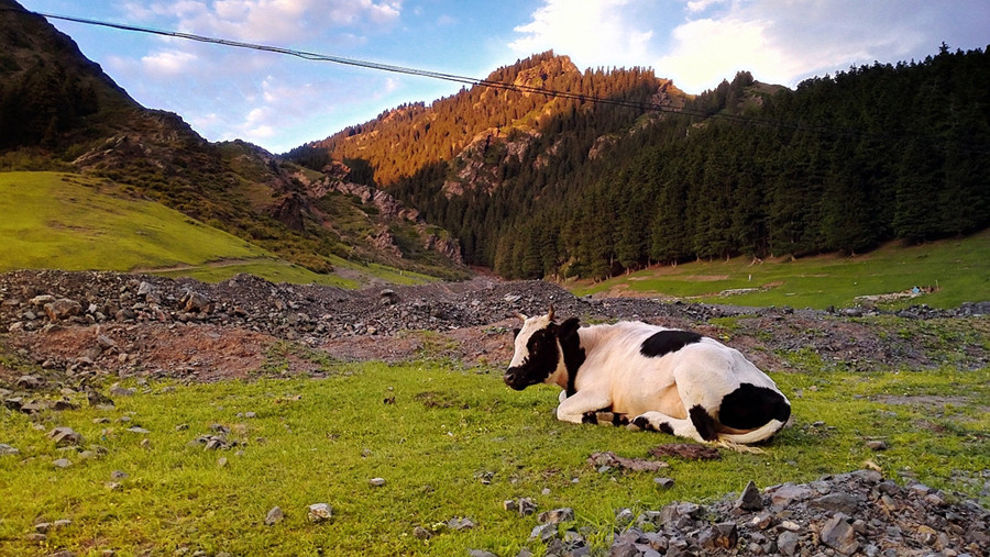
The TianShan mountain range, especially on the northern slopes, is home to vast expanses of virgin forests, primarily coniferous, with the Siberian larch forests in the eastern part. The forest belts range in altitude from 1,500 to 2,800 meters on the northern slope and 2,300 to 3,000 meters on the southern slope. The northern slope forests often mix with poplar and juniper trees, while wild apple forests and wild walnut groves are found in the western TianShan areas. These forests are crucial for the region’s ecology and contribute to timber and medicinal plant resources.
Animal Resources
The TianShan region is home to a variety of wild animals, many of which are protected species, including swans in the Bayinbuluke region (巴音布鲁克), the four-toed tortoise in the Huo City (霍城), and the Saiga antelope and wild donkeys. Other protected species include the sika deer, sable, wild sheep, snow chicken, snow leopard, and lynx. Several nature reserves have been established in the TianShan region, such as the Tianchi Natural Scenic Area (天池自然景观保护区), Bayinbuluke Swan Reserve (巴音布鲁克天鹅保护区), and Tomur Peak Protection Area (托木尔峰保护区), focusing on preserving the unique biodiversity.
Mineral Resources
Xinjiang is rich in mineral resources, with more than 120 types discovered, accounting for 81.3% of the minerals found in China. The TianShan region holds significant deposits of various minerals, including beryllium, mica, saltpeter, feldspar, serpentine, and bentonite. Coal and petroleum are abundant in the region, with large-scale oil fields such as the Karamay Oil Field (克拉玛依) expanding northward and new reserves in the Tarim Basin (塔里木盆地). Iron ore deposits in the TianShan region, including the Yaman Su Iron Mine (雅满苏铁矿) in Hami (哈密), are important for China’s industrial development.
Vegetation Conditions
The vegetation distribution varies between the northern and southern slopes of the Tian Shan Mountains. On the northern slope, the vegetation types range from mountain grassland, mountain meadow, coniferous forests, alpine meadows, alpine cushion vegetation, to glaciers. On the southern slope, the vegetation types include desert, desert grassland, arid mountain grassland, mountain grassland, eroded high mountains, and glaciers.
Natural Disasters
The Tian Shan region is prone to both geological and meteorological disasters. The geological hazards include earthquakes, mudslides, landslides, and rockfalls. Meteorological disasters include droughts, strong winds, snow damage, freezing damage, and heavy rainfall floods. Additionally, land salinization and desertification are consequences of both natural and human activities.
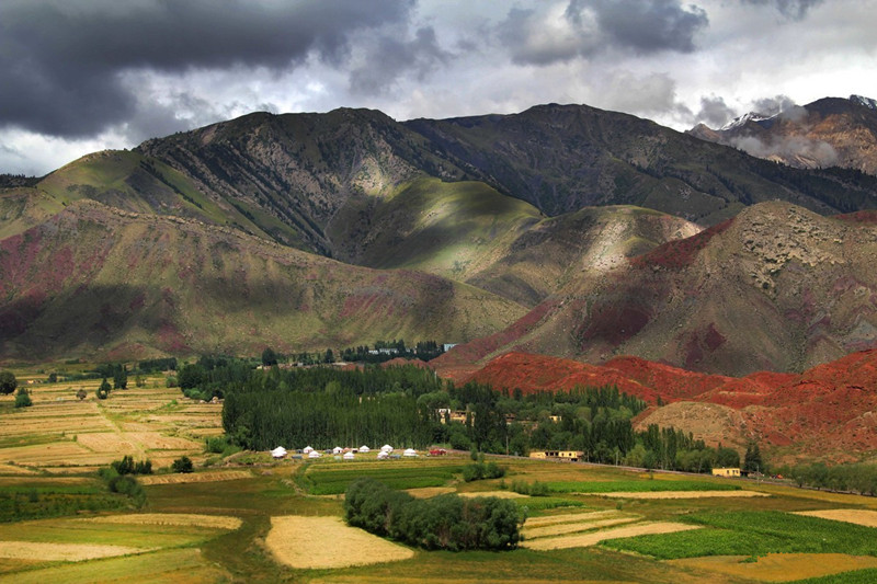
Natural Landscapes
The modern natural landscape of the Tianshan Mountains (天山山脉) exhibits both horizontal zonal differences and distinct vertical zonal structures. The Tianshan Mountain range spans across longitudes 22° and latitudes 6° with a vast expanse. The natural conditions on the southern and northern slopes, as well as the eastern and western segments, lead to notable differences in the landscape.
Northern Slope (北坡) and Southern Slope (南坡)
On the northern foot of the Tianshan Mountains, the annual precipitation is between 150-200 millimeters, with an average annual temperature of 6-7°C. The accumulated temperature of ≥10°C is between 3000-3500°C, belonging to the middle temperate semi-desert zone of northern Xinjiang, presenting a landscape of dry grassland. On the southern foot, the annual precipitation is only 60-100 millimeters, with an average annual temperature around 10°C. The accumulated temperature of ≥10°C is above 4000°C, belonging to the warm temperate desert zone, showing desert or semi-desert landscapes. These areas form the base zone of the southern and northern slopes of the mountain.
Vertical Zonal Landscape (垂直自然景观带)
The Tianshan Mountains have a very distinct vertical natural landscape. From the foot of the mountain to the summit, five major landscape zones can be observed: the mountain foothill desert-semi-desert zone, mountain grassland zone, mountain forest (grassland) zone, sub-alpine meadow grassland zone, and alpine ice-snow gravel desert zone. Some sub-zones or transition zones can also be identified between these major zones. The entire mountain range, particularly the southern slopes, has the characteristics of a mid-latitude temperate continental arid climate.
1. Mountain Foothill Desert-Semi-Desert Zone (山麓荒漠—半荒漠景观带)
This zone forms the base of the mountain landscape. It appears mainly in the extremely arid and rocky areas on the northern and southern foothills of the Tianshan Mountains (天山山脉), as well as the edge areas of large intermountain basins like Turpan (吐鲁番) and Hami (哈密). The soil is a brown desert soil rich in gravel and gypsum.
At the lower part of this zone, vegetation is dominated by drought-resistant small shrubs, forming the base of the landscape. Typical plant species include Ephedra, saltwort, Tianshan pigweed, and desert plants like bare-fruited shrubs and Ephedra. The upper part of this zone transitions into dry grassland.
In areas with a layer of loess covering the foothills, vegetation is composed of sagebrush desert, with soils being either mountain gray calcareous soil or brown calcareous soil. In some dry foothills around Yili (伊犁), a variety of low-growing plants are mixed with sagebrush desert. In the northern foothills of the Turpan-Hami Basin, the soil is a highly rocky, gypsum brown desert soil, with most areas being exposed land and only a few sections hosting salt-loving vegetation.
On the northern slope, this zone generally spans areas below 900 meters above sea level, while on the southern slope, it is mostly found in fan-shaped areas or low hill zones around 1500 meters above sea level.
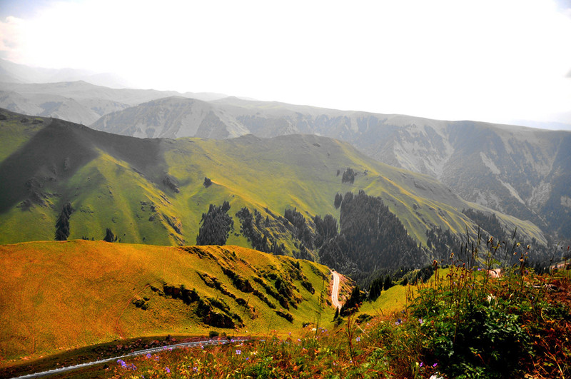
2. Mountain Grassland Zone (山地草原景观带)
This landscape zone is common on the northern foothills of the Tianshan Mountains (天山山脉), but due to the high distribution of the desert-semi-desert zone on the southern slope, this zone is forced to rise and covers most of the middle mountain and sub-alpine zones.
The Tianshan mountain grassland can be divided into two sub-zones: desert grassland and true grassland.
-
Desert Grassland Sub-zone: Found in the lower half of the mountain grassland zone, this sub-zone is dominated by drought-resistant grass species and is commonly referred to as dry grassland. It is characterized by stony mountainous terrain, with thin soil and sparse vegetation. This sub-zone is widespread on the southern slope of the Tianshan Mountains (天山山脉). The soil is mountain brown calcareous soil or light chestnut calcareous soil.
-
True Grassland Sub-zone: Generally found on the lower part of the middle mountain zone on the northern slope or along the sides of larger river valleys. This sub-zone experiences higher precipitation, thicker soil, and has a more extensive plant cover. The soil is typically mountain chestnut calcareous soil, and the dominant plant species include grasses like needlegrass, foxgrass, and icegrass.
The mountain grassland zone on the northern slope of Tianshan Mountains (天山山脉) spans altitudes between 900 and 1700 meters, while on the southern slope it is found between 1500 and 2600 meters.
3. Mountain Forest Zone or Forest-Grassland Zone (山地森林景观带或森林草原带)
This landscape zone generally aligns with the maximum precipitation zone in the Tianshan region (天山地区). On the northern slope, it appears mostly in deep-cut river valleys in the middle mountain zones. On the southern slope, it is only present in small areas on the shaded slopes of wet valleys in the sub-alpine grassland zone.
The forest zone of the Tianshan Mountains (天山山脉) is relatively simple in composition, mostly consisting of coniferous forests (snow mountain spruce). Only in some mountain slopes along the Yili River (伊犁河), which have a warm and humid climate, is there a mix of broadleaf forests, such as wild apple and wild apricot forests.
4. Sub-Alpine Meadow Grassland Zone (亚高山草甸草原景观带)
This zone is widely distributed in the northern slope of Tianshan Mountains (天山山脉) between altitudes of 2800 and 3500 meters. Its lower part is dominated by sub-alpine prostrate juniper and broadleaf shrub vegetation. In some regions of Tianshan, distinctive shrub types like “ghost-seeing trouble” shrubs can be found at the same elevation.
Sub-alpine meadow grasslands form summer grazing grounds, with soils of sub-alpine meadow type.
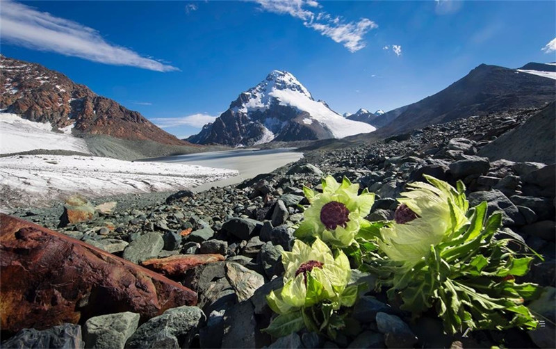
5. Alpine Ice-Snow Gravel Desert Zone (高山冰雪砾漠景观带)
This zone is located above 3500 meters on the northern slope, and higher, above 3900 meters, on the southern slope. Some areas, like Mount Tomur (托木尔峰), reach up to 4500 meters. The lower part of this zone is an alpine gravel desert, with strong frost weathering and numerous stone cones and rock debris slopes.
This zone has few plant species and is mainly composed of Tianshan snow lotus and other alpine plant types like mosses and lichens. The upper section of the zone consists of bare rock, glaciers, and permanent snow regions, particularly around altitudes of 3900-4000 meters, where modern glaciers have carved the landscape.
At these altitudes, human presence is scarce, and the landscape is desolate. The modern snow line in this area varies, generally between 3700-3950 meters on the northern slope and between 4000-4500 meters on the southern slope.
TianShan Tianchi Scenic Area (天山天池风景区)
The TianShan Tianchi Scenic Area is a UNESCO World Heritage Site, a 5A national tourist attraction, a national geological park, and a key national scenic area. The main feature of the TianShan Tianchi Scenic Area is Tianchi Lake, surrounded by four vertical natural landscape zones, glaciers, snow-capped mountains, and alpine lakes. The area also embodies the cultural connotations of the ancient myth of Queen Mother of the West, religious significance, and unique ethnic customs. The scenic area integrates forests, grasslands, snow mountains, and cultural landscapes, offering a unique and spectacular view.
Cultural Landscape
West Queen Mother Ancestor Temple (西王母祖庙)
The West Queen Mother Ancestor Temple is located on the eastern shore of Tianchi Lake, northwest of Mount Bogda, at an elevation of about 2,000 meters. It is one of the oldest Taoist temples in Xinjiang at such a high altitude. Legend has it that the Queen Mother of the West achieved immortality here, hence the name West Queen Mother Ancestor Temple.
Historical and Cultural Significance
East Tianshan Culture (东天山文化)
The East Tianshan area has been home to advanced prehistoric cultures for over 4,000 years. The remains of early nomadic tribes, such as the Yuezhi and Wusun, can be found, alongside evidence of the integration and development of nomadic and agricultural cultures. Hami, located in the East Tianshan, is a symbol of the region, where the desert, Gobi, and oasis of the Hami Basin are located to the south, and the grasslands of Barlik and Yiwugu are found to the north. The diverse natural environments of Hami have cultivated both grassland and oasis cultures, as well as agricultural traditions. Being a key traffic hub between Xinjiang, China, and Central Asia, Hami exemplifies a blend of multi-ethnic and diverse cultures.
Mythological Stories
According to the “Mu Tianzi Biography,” King Mu of the Zhou Dynasty, 3,000 years ago, traveled westward to the TianShan Mountains in a chariot drawn by eight horses. The Queen Mother of the West greeted him at Tianchi Lake. King Mu presented luxurious silks and fabrics from Central China, and in return, the Queen Mother of the West gifted him rare treasures from the TianShan. She also invited him to tour the famous attractions of the region. King Mu wrote “Mount of the Queen Mother of the West” as a commemorative inscription. Before parting, the Queen Mother of the West sang, saying: “I wish you long life and hope you return again.”
World Heritage
In 2013, at the 37th World Heritage Conference, the Tianshan Mountains of Xinjiang, including the Tomur, Karajun-Kurdening, Bayinbuluke, and Bogda areas, successfully applied to be designated a UNESCO World Natural Heritage site. These four areas, located in the western, central, and eastern parts of the Tianshan, are considered the most representative regions of the Xinjiang Tianshan Mountains. They include the main peak areas, valleys, and large intermontane basins.
- Tomur: A prime example of glacial landscapes and red-layered canyon natural beauty.
- Karajun-Kurdening: Located in the Ili River valley, this area is rich in biodiversity, with over 2,600 vascular plants and 550 vertebrates recorded, alongside numerous rare and endangered species.
- Bayinbuluke: A typical intermontane basin and the most representative example of temperate, arid, high-altitude wetland ecosystems.
- Bogda: The northern peak area of the Tianshan, with the highest number of protected animal species, including snow leopards, wild goats, and lynx.
The Xinjiang Tianshan mountains offer a diverse and breathtaking natural landscape and are a critical example of ongoing ecological and biological evolution in temperate, arid mountain regions.
Ecological Protection
Tomur Peak National Nature Reserve (新疆托木尔峰国家级自然保护区)
Located in the Wensu County of Aksu Prefecture, Xinjiang, the Tomur Peak National Nature Reserve spans an area of 237,600 hectares. It was established in June 1980 and upgraded to a national reserve in 2003. The reserve protects forest ecosystems and serves as a center for glacial activity.
Western Tianshan National Nature Reserve (西天山国家级自然保护区)
The Western Tianshan National Nature Reserve, located in the Ili region, has a total area of about 28,000 hectares. It is known for its abundant biodiversity and seven vertical natural landscape zones, ranging from the frigid zone to the subtropical zone. The reserve is famous for its coniferous forests, particularly the spruce forests that provide habitat for various wildlife.
In 2013, the Xinjiang Tianshan was successfully listed as a World Natural Heritage Site, marking China’s 44th world heritage site. The “Xinjiang Tianshan” World Natural Heritage area spans 1,760 kilometers and covers 5,759 square kilometers, accounting for over three-quarters of the entire Tianshan range.
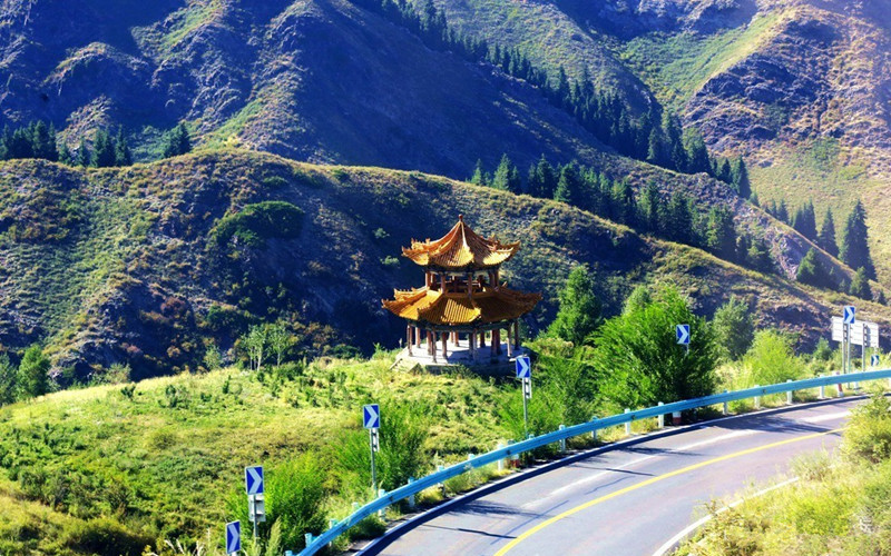
Main Attractions of Tian Shan Mountains
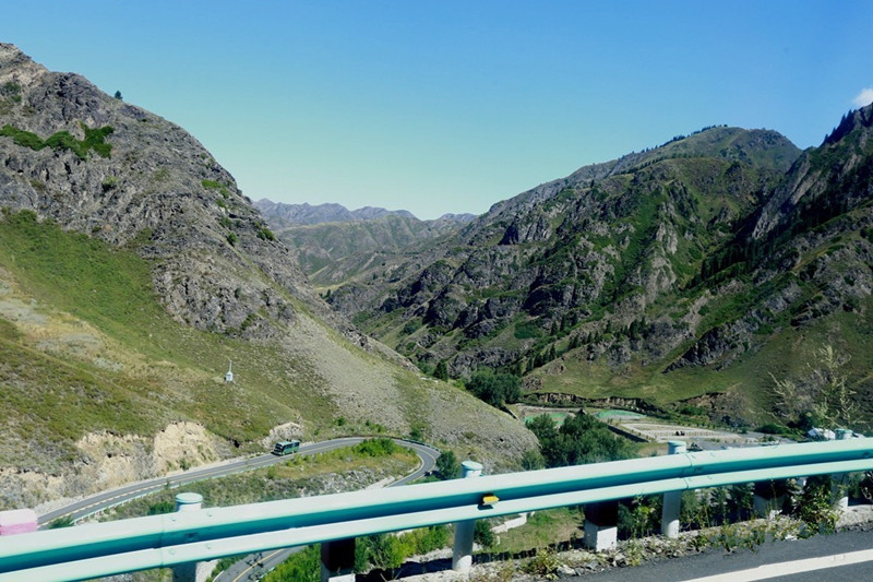
Tian Shan Mountains spans across the whole Xinjiang with a length of 1,760 kilometers. It is also worth to mention that ‘three mountains clip two basins’ is the geographic feature of Xinjiang. With the Altai Mountains on the north boundary and the Kunlun Mountains on the south boundary, the Tian Shan Mountains in the middle is the natural geographical dividing line between Junggar Basin and Tarim Basin.
The highest peak – Pobeda Peak at 7,435.3 meters, there are tens of peaks along the Tian Shan Mountains including Khan Tengri and Bogda Peak. And what makes the Tian Shan Mountains more remarkable is that a high mountain lake – the Heavenly Lake. About 110 kilometers away from Urumqi, the lake is located in a valley at 1,943 meters on the northern slope of Bogda Peak.
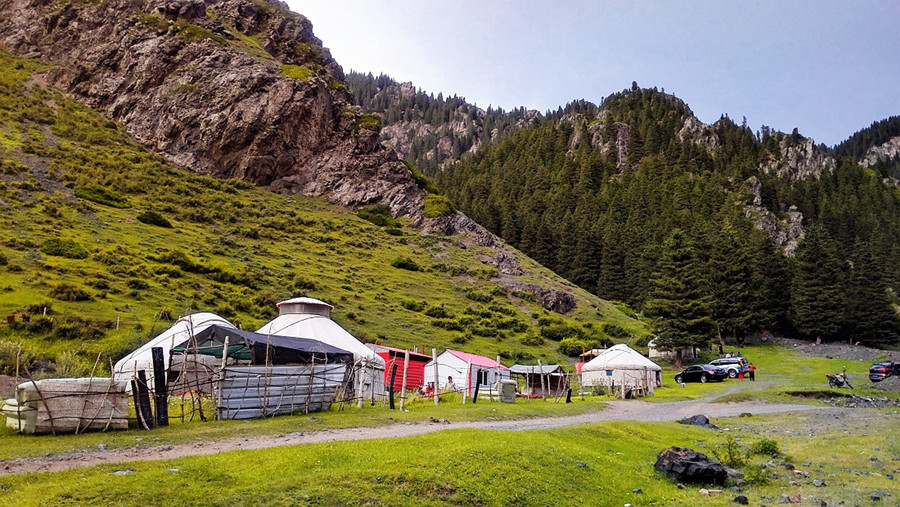
Aside from Tianshan Wild Animal Park, which is located at the southern foot of Bogda Mountain, the Southern Pasture and Ili Nalati Grassland are also famous tourist attractions along the Tian Shan Mountains which are highly recommended for visitors who enjoy horse racing and the kazakh folk customs.
How to get to Tian Shan Mountains
Travel with ChinaDragonTours (top recommended)
If you want to get out of the traffic and hassle of navigation, you can book a private tour package that includes visiting, dining and transfer from us. Our local guide and driver will escort you to the Tian Shan Mountains and most convenient way and take care of all the details. You just have to focus on the visiting.
Independent Traveler
Take a bus from Urumqi Beijiao Bus Station to Fukang, and then transfer to another bus from Fukang Bus Station to the Heavenly Lake.
Useful Travel Tips
The Best Time to Travel
The best time to travel to Tian Shan Mountains is in summer from June to August when there are beautiful grasslands, cattle and sheep flocks and boundless rape flowers. Besides, for those who favor to enjoy the snow, they are suggested to visit the Mountain before December or after February because the mountain climate between December and February is severe cold and often with wind of force more than 8.
Attention
Take along enough warm clothes even if you plan to visit in summer due to the big temperature difference between day and night in the mountainous areas. Also, pay attention to weather changes before visit, especially, the weather forecast for sandstorms.


